


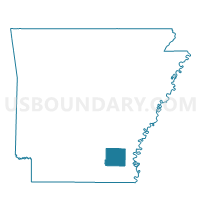
Tillar Voting District, Drew County, Arkansas
About
Outline

Summary
| Unique Area Identifier | 526407 |
| Name | Tillar Voting District |
| County | Drew County |
| State | Arkansas |
| Area (square miles) | 14.60 |
| Land Area (square miles) | 14.16 |
| Water Area (square miles) | 0.45 |
| % of Land Area | 96.95 |
| % of Water Area | 3.05 |
| Latitude of the Internal Point | 33.71263230 |
| Longtitude of the Internal Point | -91.48755080 |
Maps


Graphs
Select a template below for downloading or customizing gragh for Tillar Voting District, Drew County, Arkansas


Neighbors
Neighoring Voting District (by Name) Neighboring Voting District on the Map
- Clayton Voting District, Desha County, AR
- Selma Voting District, Drew County, AR
- Tillar City Voting District, Desha County, AR
- Winchester Voting District, Drew County, AR
Top 10 Neighboring County Subdivision (by Population) Neighboring County Subdivision on the Map
- Franklin township, Drew County, AR (617)
- Clayton township, Desha County, AR (575)
- Live Oak township, Drew County, AR (498)